Thursday, 27 September 2007

3D virtual worlds for the blind

A news item which I found very interesting recently concerns the extension of online virtual worlds to blind people thanks to research by students at IBM in Ireland. Estimates predict that 80% of active internet users will be using a virtual world in four years' time (a figure that based on the popularity of Second Life can't easily be disputed). The company is keen to ensure that blind people are not excluded from an environment that sighted people will take for granted and has thus designed an audio equivalent of the virtual world using 3D sound to create a sense of space.

The initial project - called Accessibility In Virtual Worlds - is what the company describes as "a proof of concept" at this stage but will be passed on to IBM's Human Ability and Accessibility Centre in Texas for further development. The Irish team decided to use the Active Worlds online environment rather than the more popular Second Life for flexibility reasons. Active Worlds is a collection of user-made virtual worlds that people can visit via a web browser plug-in.

To offer a better insight on how this all works; "When the user comes into the world, the items are described as well as their positions," explained Colm O'Brien, one of the team of four researchers who worked on the project. "There is also sound attached - for example, if there's a tree nearby you will hear a rustling of leaves," said Mr O'Brien. The work also developed tools which uses text to speech software that reads out any chat from fellow avatars in the virtual world that appears in a text box. Characters in the virtual world can have a "sonar" attached to them so that the user gets audible cues to alert them to when they are approaching, from which direction and how near they are.

A number of blind mentors have given advice and feedback to the team - one in IBM's Dublin lab and two based at IBM's research centre in Texas. The team also liaised with the National Council for the Blind of Ireland on their work. As well as proving that the idea is feasible, the team has made a number of recommendations about accessibility standards for virtual worlds which should help the developers of the future.

All in all this is an extremely interesting and innovative piece of research work in the general area of virtual urban modelling, for more information check the links below, the first one for the original BBC story and the second for the IBM site in question...


Thursday, 20 September 2007

In-car GPS navigation finally moving towards 3D?

A very important development in the world of urban modelling is the fact that car GPS systems finally seem to be moving towards 3D... European Sat Nav users will soon be able to navigate through cities with 3D models of buildings and landmarks displayed life-like onscreen.

Digital map provider Tele Atlas (http://www.teleatlas.com/) is set to release detailed 3D maps of nearly 50 cities for use in navigation devices and location-based applications. The first detailed 3D city maps will include major capital cities such as London, Berlin and Rome. Additional European, US and Asian city maps will follow over the next year. It should be noted here that Tele Atlas provides mapping information for many major Sat Nav and location-based product and service developers, including market leader (and very very popular in the UK!) TomTom. You can see a brief demo of the prototype of this all at the YouTube link below.

As well as displaying prominent landmarks in 3D, Tele Atlas maps will feature textured cityscapes rather than flat representations. Additionally, major landmarks, such as the Tower of London and Berlin's Brandenburg Gate will be modelled in detail on the 3D maps... The 3D maps will initially cover around 40 square kilometres per city. Even more importantly Tele Atlas representatives mention that as the move towards pedestrian navigation and location services gathers pace, 3D imaging of street level points of interest such as train stations, bus stops and so on will become more important... Tele Atlas also claims its research shows that 81 per cent of consumers prefer 3D maps over 2D versions, with stronger interest in 3D city maps.

I will await the developments of this with great interest, car navigation is certainly a rapidly expanding area today and seeing it starting to embrace the 3D urban modelling concept is certainly not only very encouraging, but also prone to open up immense possibilities for all aspects of work attached to it...

Urban Environment Creation In Maya instructional DVD

For all the Maya users out there interested in a comprehensive urban environment tutorial, there's nothing I could recommend more than Digital Tutor's Urban Environment Creation in Maya instructional DVD.

The tutorial DVD covers an entire, thorough and from scratch production workflow to creating urban environments and time-saving modeling, texturing and UV mapping techniques that can be used for film, games and architectural visualizations of building structures. It contains over 6 hours of project-based training and is great for intermediate artists or even people still finding their feet with Maya and 3D urban modelling. Some of the areas it covers include:

- Hard Surface Modeling Techniques
- Modeling with Texture
- Modeling to a Camera
- Strategically Adding Detail
- Simulating Aging and Decay
- UV Layout Techniques
- Using UV Snapshots
- Integrating Maya and Photoshop
- Generating Displacement Maps
- Texture Painting with Photoshop
- Layering Textures
- Tiling Textures
- Generating Procedural Maps
- Adding Architectural Elements
- Creating Interior Illusions with Textures
- Connecting Maya Texture Nodes
- Complex Scene Management
- Scene Optimization for Rendering

For more information about the DVD, purchasing it, sample pics and even a sample video lesson visit http://www.digitaltutors.com/store/product.php?productid=2783&cat=39&page=1.

GPS keyring anyone?

Your phone, PDA (or even laptop, see post below) may have GPS capabilities, but who wants to carry around a receiver everywhere you go? However, what if the receiver was tiny ... and also doubled as your key ring? According to http://www.endgadget.com/ that's exactly what Proporta is proposing with its latest "world's smallest" (a claim I have to say I am not entirely convinced by) GPS receiver, the Freedom.

The ultra-compact device does in fact function as a key fob, in addition to being a SiRF Star III-equipped receiver which can interface with whatever friendly device you happen to have nearby. The Freedom will last you nine hours on a single charge, connects with up to 20 satellites, and plays nice with Bluetooth devices, making your navigational world slightly more enjoyable. The little guy is available right now for €99.95, or $129.99. Admittedly it looks like a very cool little gadget.

For more information about the Freedom GPS check http://www.proporta.com/.

Wednesday, 19 September 2007

3D urban modelling used in vodka commercial

I am not usually one to dissect advertisements very much (although there are several which are quite clearly small work of arts when it comes to visual effects and post production), however a very recent one selling (of all things!) Smirnoff vodka found me very interested in it... The reason? Well, it's not very often you see some very elaborate stylized, clay-rendered urban 3D modelling examples of landscapes of major capital cities in a commercial!

As you can see on the pic above and also the YouTube link, the ad in question chooses to portray the vodka as a flowing red liquid marching its way through the Russian capital, then onto Paris and then onto glipses of other capitals. The modelling throughout is superb and is very nicely complimented by some great camera work that really captures the detail of the urban meshes presented.

All in all, it is a very interesting piece of work that shows just how much of age 3D urban modelling has come the last few years in order to be picked as a concept to represent major brands in high-profile marketing strategies.

GPS equipped Asus laptop

Something which caught my eye recently and which seems to be setting a new trend; a laptop with GPS integrated capabilities. Asus looks to be keeping busy on the GPS front these days, with it now following up its just-introduced navigators with what it claims to be the "world's first mainstream notebook PC with integrated GPS capability" (certainly the first one I've read about).

That particular distinction goes to the company's new U3S laptop, which relies on NXP Software's swGPS system for navigation duties. Amongst other things, NXP's system does all the necessary GPS signal processing entirely in software, which not only allows it to be much smaller but also opens up the possibility of fairly significant software upgrades (including support for Galileo). From the looks of it, the laptop itself is also no slouch, with the usual Centrino Duo-related goods and some unspecified discreet graphics under the hood. Just don't expect "mainstream" to mean "cheap," with the laptop set to run €2,300 (or $3,200) when it's released later this month...

Still, something that will hopefully be a trendsetter, there's enough PDAs out there with built-in GPS, having computationally more powerful devices also come with one can only open up possibilities...

Animex 2008

For today's post a shameless plug to what is, arguably the best computer animation festival in the UK at the moment, Animex, The International Festival For Animation & Computer Games, running for a number of years in a row at Teesside University, Middlesbrough, UK where I did my MA in Computer Animation (back in the day ...). The festival this year will be running between the 4th and the 8th of February.

The festival has its roots firmly planted in the creative side of animation and computer games and acts to provide animators, directors, students, artists, designers, writers and educators with a forum in which they can share their knowledge and skills and promote the art of animation and games. Festival delegates are able to attend talks (often from very prestigious people in the area!), presentations, workshops, screenings and parties.

A short list of this year's activities includes an awards ceremony, an open-plan exhibition area, a dedicated to computer games special event, an animation lounge and a variety of technical workshops and tutorials. While the list of invited speakers for this year's festival is not yet confirmed (seeing that the festival is a few months away), last year's event included, most notably, Ed Hooks (a well known pioneer in acting training specifically designed for animators) and Eamonn Butler (long-time Disney employee) amongst others...

Whether you're an industry heavyweight, a freelancing artist, a new company, a student, a researcher or even if you're just interested in animation or computer games, Animex is the place to be in 2008. Since 2000 Animex has been pioneering events that make the festival a unique experience for all of its visitors and is not only worthy of support but also capable of capturing the imagination for a number of related research matters...

For more info on Animex 2008 (such as obtaining tickets) and Teesside University check the following links, http://animex.tees.ac.uk/ and http://www.tees.ac.uk/.

See you there!

New version of Softimage XSI

One of my favourite 3D modelling packages (and the one I mostly used for my Masters work) has been getting an update/rerelease... Softimage has announced the latest versions of its 3D animation software packages: SoftimageXSI 6.5 and SoftimageFace Robot 1.8.

Both will ship in the autumn, according to the company. The company also announced plans to "repackage its Essentials and Advanced versions of SoftimageXSI 6.5 software to meet the specific needs of artists and studios, respectively", essentially changing which features are in which version, and also the pricing, to appeal better to certain users. Both SoftimageXSI 6.5 Essentials and Advanced software will include more than thirty enhancements that were developed for creative companies such as Lionhead Studios, Valve, EA, Animal Logic, Nerdcorps, Pandemic and NCSoft (according to Softimage again).


New tools across both versions include HDR (high dynamic range) rendermap support, additional SDK APIs allowing programmers to extend the software's capabilities, UV editing enhancements, and enhanced audio support. SoftimageXSI 6.5 Essentials is now aimed at artists creating 3D characters and content for games, film and television. The Essentials version now includes Hair & Fur, and Syflex Cloth capabilities. The price for Essentials will increase to $2,995 (around £1,470); maintenance remains unchanged at $799 (£392), and upgrades remain unchanged at $999 (£490). XSI 6.5 Essentials will only be available to new customers and customers on active maintenance. SoftimageXSI 6.5 XSI Advanced on the other hand is aimed at technical directors and studio IT managers. It includes everything in the SoftimageXSI 6.5 XSI Essentials package, plus Behavior, a crowd and behavioral simulation system, as well as five additional XSI Batch rendering licenses. The price for Advanced will decrease to $4,995 (£2,450) and maintenance will decrease to $1333 (£653).

For more information, check the official Softimage site at http://www.softimage.com/

Thursday, 16 August 2007

Urban modelling via a multi-touch display wall

Urban modelling is arguably an area that has yet to benefit from 3D interaction and quite understandably so since the work involved is often very complex and large-scale and doesn't really lend itself to HCI experimentation. However, Autodesk Labs plans to change all that and has recently unveiled vids of a new research prototype of a novel urban design application.

This prototype runs on a Multi-Touch Wall, a multi-touch input device produced by Perceptive Pixel (link here) and invented by researcher and TED conference luminary Jeff Han. Single touch devices, such as a for example a tablet PC or kiosk at a shopping mall, have been around for years. What distinguishes a multi-touch device from its predecessors is that it recognizes more than one input simultaneously. That means that instead of just touching the screen with the tip of one finger, the device recognizes gestures that the user makes with one or more fingers. Recognizing these gestures can provide computer applications with new opportunities for processing user input...

Therefore, Autodesk Labs believes multi-touch human-computer interfaces may dramatically change how products, infrastructure, and buildings are designed. In the vid above you can see someone grab a section of a city and mock up a building on the site. It looks really exciting (despite the lack of audio commentary on the vid) and could well spark off new avenues in urban modelling research when the project is complete and made commercially available.

Wednesday, 15 August 2007

Spellbinder project: mobile snaps revealing invisible art

A very interesting research project, unveiled at the recent SIGGRAPH 2007 conference, that has only recently come to my attention is the Spellbinder one, developed by Scottish researchers at the Division Of Informatics at the University of Edinburgh. The main objective of the project is to turn to camera phones, an accessory available on just about every cellphone these days, to help bridge the gap between virtual and real worlds.

The essence of the project is that via the use of image-matching algorithms the real world is adorned with digital content. The technology developed has already been used to create a guide of Edinburgh that allows people to find virtual artworks (such as for example graffiti, pictured above) placed around the city using their mobile... Another related spin-off application derived from the Spellbinder project uses the same technology to automatically update a person's blog with their location. According to Dr Mark Wright who came up with the original idea "it's about using a camera phone as a magic wand".

A key component of the Spellbinder is the database of all the places that participants have added data to. Thus, people can query it by taking a snap of a location with their phone then using multimedia text messages to send it to Spellbinder. Moreover, again according to the creators, powerful image-matching algorithms are used to analyse the image that can deal with snaps of the same place being taken under different lighting conditions or orientations. Once the system has worked out the location of an image it consults the database and sends back an image with the extras added to it.

All in all this looks like a very interesting concept that very notably manages to combine virtual & augmented reality issues, mobile blogging, urban navigation & representation, invisible art and even location based services and could indeed have many extensions and forays in other fields too...

Below you will find a link for the original BBC News story on Spellbinder:

New version of 3D Studio Max out in October

Autodesk, Inc. has just announced the new version of this writer's favourite 3D modelling application, 3ds Max 2008. While the naming is somewhat perplexing (what happened to version 10?!) 3ds Max 2008 is said to containe new features that enable artists and designers to further overcome challenges associated with large and complex 3D datasets (such as urban models). The software has been used to create numerous notable projects, including visualizations for the EMI Records building in London, the Mass Effect game and the Grindhouse movie. 3ds Max 2008 was showcased during SIGGRAPH 2007, being held at the San Diego Convention Center between August the 7th and the 9th.
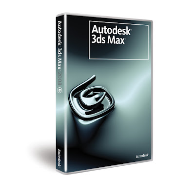
Robert Stava, creative director at 3D Media Group and 3ds Max 2008 beta tester said, "Autodesk 3ds Max 2008 quickly became a standard part of our production pipeline. With many of our architectural design projects tipping the scales at millions of polygons, 3ds Max 2008 software's improved handling of complex data is a very welcome addition." 3D Media Group recently used 3ds Max to create visualizations for the Fulton Street Transit Center in New York City, the Zayed Stadium in Abu Dhabi and the New Songdo City in Korea.

Here's a quick overview of some of the key new features of this new version:

1. Accelerated Performance
The integration of new technology into the software’s Adaptive Degradation System improves interactive performance by automatically simplifying scene display to meet a user-defined target frame rate. You control how 3ds Max adjusts scene display—whether the smallest objects are hidden, or distant objects have less detail, etc.—and 3ds Max calculates how best to achieve it. When combined with the new Direct3D® mesh caching that groups objects by materials, the result is that tens of thousands of objects can be just as interactive as ten objects. In addition, loading, arrays, Autodesk® FBX® and OBJ export, and other areas of the software perform significantly faster.

2. Scene Explorer Scene Management
3ds Max 2008 delivers Scene Explorer, a robust new tool that provides you with a hierarchical view of scene data and fast scene analysis, along with editing tools that facilitate working with even the most complex, object-heavy scenes. Scene Explorer gives you the ability to sort, filter, and search a scene by any object type or property (including metadata), with stackable filtering, sorting, and searching criteria. This new tool also enables you to save and store multiple Explorer instances and to link, unlink, rename, hide, freeze, and delete objects, regardless of what objects are currently selected in the scene. You can also configure columns to display and edit any object property, and because this feature is scriptable and SDK extendable, you can use callbacks to add custom column definitions.

3. Review
This powerful new toolset gives you immediate feedback on various render settings, enabling you to iterate rapidly. This means you can now quickly hone in on your desired look without waiting for a software render—erfect for over-the-shoulder client/boss feedback sessions and other iterative workflows. Based on the latest game engine technology, Review delivers interactive viewport previews of shadows (including self-shadowing and up to 64 lights simultaneously), the 3ds Max sun/sky system, and mental ray® Architectural and Design material settings.

4. MAXScript ProEditor
3ds Max 2008 marks the debut of the new MAXScript ProEditor. This intuitive new interface for working with MAXScript includes multilevel undo functionality; fast, high-quality code colorization; rapid opening of large documents; line number display; regular expressions in search/replace; folding of sections of the script; support for user customization; and many other features.

5. Enhanced DWG Import
3ds Max 2008 delivers faster, more accurate importing of DWG™ files. Significantly improved memory management enables you to import large, complex scenes with multiple objects in considerably less time. Improved support for material assignment and naming, solid object import, and normals management facilitate working with software products such as Revit Architecture 2008. Plus, a new Select Similar feature identifies all objects in an imported DWG scene that contain characteristics similar to those of a selected object. This capability lets you select and edit multiple imported objects simultaneously—dramatically streamlining DWG-based workflows.

6. Artist Friendly Modelling Options
3ds Max 2008 gives you a more streamlined, artist-friendly modeling workflow through a collection of hands-on modeling options that let you focus more on the creative process. These options include selection previewing and the ability to have existing modeling hotkeys and pivots become temporary overrides.

7. Biped Enhancements
This latest release provides you with new levels of flexibility with regard to your Biped rigs. A new Xtras tool lets you create and animate extraneous Biped features anywhere on your rig (for example, wings or additional facial bones) and save them as BIP files. These files are supported in Mixer and Motion Flow, as well as in Layers, where new layering functionality enables BIP files to be saved as offsets from each layer to isolate character motion. As a result, each layer can be saved as its own asset for export into a game.

8. Expanded Platform Support
3ds Max 2008 is the first full release of the software officially compatible with Microsoft® Windows Vista™ 32-bit and 64-bit operating systems and the Microsoft DirectX® 10 platform.

Autodesk anticipates that 3ds Max 2008 will be available in English in October 2007. For a complete list of new features and enhancements in Autodesk 3ds Max 2008, visit http://www.autodesk.com/3dsmax.

Monday, 13 August 2007

Dell Axim x51v and Windows Mobile 6

With the release of Windows Mobile 6, various PDA manufacturers have taken the plunge to make sure their already released Pocket PC devices can be upgraded to the new operating system. Well, Dell is certainly not one of those manufacturers... While it is understandable to an extent (the Axim line seems to be one that will be discontinued) it nonetheless is very frustrating to a user of the device (such as myself, it's been with me since it was released and has proved to be an extremely robust, reliable and very powerful graphics-wise PDA).


The video above (showing a Dell Axim x51v running Windows Mobile 6!) is the proof that user communities can sometimes overcome little issues such as devices getting obsolete by their manufacturer. It seems that a ROM is out there that allows the new version of the operating system to be loaded on the device. While I'd rather not post any links as to where one can find this ROM, it does reportedly provide Axim users with the capability of upgrade denied by Dell (albeit as a slighty more risque proposition, ROMs like this often tend to be incredibly buggy and are not really recommended). Moreover, it applies further pressure to the manufacturer to step up to the challenges of a still-existing customer base. Have I attemped the upgrade? No way, and I certainly won't as I am not convinced WM5 and WM6 differ greatly but also because I value my device way too much and will always wait for an official update from Dell...

Nintendo developing a new motion sensing portable device?

For today's post, a new (or perhaps even better, hybrid) concept which is certainly interesting, concerning interaction & mobile devices capable of 3D graphics. It seems that Nintendo has caught on as to how important their Wii motion-sensing controller has been to their sales and are trying to apply it to its mobile counterpart, the Nintendo DS. That seems to be the idea behind a recent patent application from Nintendo, which is for a handheld gaming device with Wii remote-esque motion-sensing abilities.

The housing of the system incorporates an XY-axis acceleration sensor to detect an acceleration in an X-axis and Y-axis direction and a Z-axis contact switch to detect an acceleration in a Z-axis direction. In diagrams (see pic above), the system has been represented by a Game Boy-esque figure, but it could well be that's just a temporary placeholder.

While it should be noted that mobile devices with motion sensors are certainly nothing new, this has been more or less limited to cellphones so far and seeing that a device capable of displaying more complex 3D graphics extend to include it as a viable interaction way is very exciting indeed! Time will show what Nintendo will make of this of course as this is a long way from implementation yet. Still, the idea alone sends the imagination reeling when it comes to potential applications...

Monday, 6 August 2007

Tutorial on creating a photorealistic 3D virtual city in under 5 minutes

Quite often I've had to produce random visualisations and renders of 3D urban models for my work with time being a key element. In this post I have decided to describe an easy, cost-efficient and most of all very fast (less than 5 minutes all in all!) way to do that.

First of all, you will need a version of Autodesk's 3D Studio Max to follow this quick tutorial. Also, you will need a copy of the excellent Greeble plug-in, developed by Tom Hudson. This is a modifier plug-in useful for generating random detail for everything ranging from spaceship models, cityscapes to Death Stars (!), which can be downloaded from http://max.klanky.com/ (to install it simply copy and paste the Greeble .dlm file in the 3D Studio Max Plugins directory).

Step 1: Create a plane in 3D Studio Max with say 25 Length and 25 Width. Make sure Edged Faces is on from the viewport options (very important!).

Step 2: Apply an Edit Mesh modifier to the plane and then proceed to select every third or fourth row of polygons horizontally. Non-uniform scale these rows of polygons to 50%-60% of their size and then delete them. You have created horizontal streets in your random 3D city. Now repeat the process vertically in exactly the same way only this time it doesn't have to be in continuous rows. Remember we're trying to keep the appearance somewhat not-too-"blocky" looking and fairly randomized...

Step 3: Keeping this in mind move around some vertices here and there in the corners of all buildings to randomize the appearance of the cityscape further.

Step 4: Open up the Material Editor and in a new material slot create a Multi/Sub-Object material. Apply this to the cityscape plane. This is done in order to differentiate different parts of the cityscape. I usually use about 4-5 slots in this but let's keep it simple for this tutorial; use only two and name the 1st Base and the 2nd Garden. Assign a different sub-material to each; say a yellow-ish diffuse color for the Base and green for the Garden.

Step 5: Now under the Polygons selection of the Edit Mesh modifier, assign different material IDs to polygons accordingly. The easy way to do this is to select all polygons, assign them as ID1 (Base) and then select the few Garden polys you want and assign ID2 to them (you will see that the Garden ones turn green while all others remain yellow in color). Finally select ID1, all the Base polys that is.

Step 6: Apply the Greeble plug-in! You probably have what is more or less a random 3D city by now. With a few minor tweakings you can get it even better but even the default settings should be good enough! I usually set Taper to 0, make sure I use all 5 Widgets available, with their Density set at 5 etc.

Step 7: To produce a clay-like render add a Skylight to the scene and then render with some Advanced Lighting->Light Tracer (using the added Skylight). This should produce a render like the one below.

As you can see, it is fairly simple and time efficient to achieve results such as this for purely random visualisations. Obviously the shortcomings of this are obvious (for starters geographically it is difficult, nigh-on impossible to adapt this technique to a more realistic GIS-driven target) but this method (and the Greeble plug-in itself!) take some beating in the time/quality of result ratio for purely "beauty" renders. (Also do bear in mind that I've tried to keep this really really simple, there are many ways to build on and improve on the few steps described above, by no means is this definitive, feel free to experiment!).

For a future tutorial I will concentrate on the production of expressively rendered (i.e. in a non-photorealistic manner) views of 3D urban models, check the pic above for a cartoon-shaded view of an urban model...

MaPZone, a very useful texturing editing tool

One utility I have recently found extremely useful for my work, MaPZone, Allegorithmic’s free procedural texture generation tool, will soon be upgraded to version 2.6. The tool enables users to create seamless, high-quality textures based on a compositing graph which will automatically tile and can be locally edited (amongst many other features, check the link below for all of them). The update, set to be released sometime in the fall of this year, will bring about the ability to input bitmaps so that they can be mixed with the procedurally generated layers that the program specialises in, as well as several other usability improvements.

Well worth a look for all 3D modellers also heavily involved with texturing work, more information on the application, tutorials, a community forum, as well as of course the ability to download the freeware version at http://www.mapzoneeditor.com/.

Saturday, 4 August 2007

Google PhotoSketch, a method for image-based rapid photomodelling

According to a Google Tech Talk recently given by George Wolberg a technology has been developed designed to take casual photographs and convert them quickly into texture-mapped 3D buildings. The technology, called PhotoSketch is intended to automate as much of the process as possible, while still requiring some human input. The key is that the methods do not require expensive cameras, laser finders, etc. It operates by extrapolating camera angle and position from the derived 3D of the building based on the photos. The key contributions of this work is that it merges the benefits of automatic feature extraction, multiview geometry, an intuitive sketching interface and also dynamic texture mapping to produce lightweight photorealistic 3D models of buildings.

The talk can be viewed at the link below and while it clocks in at slightly less than an hour (!) it is well worth watching since it presents general city modelling issues as they stand today, an overview of the system proposed and also results from experiments in large-scale urban scenes. Finally, the results are designed to integrate with Google SketchUp and are thus particularly suited to creating buildings for display in Google Earth.

http://video.google.com/videoplay?docid=-4452669873579375047

Google SketchUp For Dummies book

Another useful book I have come across recently is Google SketchUp For Dummies, written by Aidan Chopra. While Google's SketchUp is far easier and less complicated than something such as a more dedicated modelling application like 3D Studio Max, it is nonetheless in need of some sort of reference manual to take you through the full variety of features it is equipped with.

While the book itself is more than adequate on that, what is even more impressive is that the author has uploaded 62 tutorial vids to compliment the book release and all of these tutorials are entirely free and can be found on YouTube! A great move both in a marketing and also SketchUp-community sense and one that leads me to recommend this book even more! For more info on the book see http://www.sketchupfordummies.com/.

The author's vid tutorial site on YouTube can be found at http://www.youtube.com/profile_videos?user=aidanchopra&p=r&page=1.

City GML, providing an open standard for 3D city models

Services such as the very popular Google Earth and Virtual Earth (both covered in this blog), while pushing the 3D urban modelling field to its limits in more ways than one also carry a lot of limitations. One of the most important ones is that these web services largely provide only graphic or geometric models, neglecting the semantic and topological aspects of the buildings and terrain being modeled.

These 3D models can only be used for visualization purposes but not, in most cases, for thematic queries, analytical tasks or spatial data mining. Another problem with these and other city 3D modeling efforts is lack of interoperability. Web-aligned open standard geometry models for computer graphics (e.g., X3D and geospatial technologies (Geography Markup Language 3 (GML3)) are available but still relatively new and not yet widely adopted. Though their common XML foundation provides the elements needed for convergence, this has not been addressed (not yet anyway). Moreover, in those cases where semantic and topological aspects are considered, there are no widely used standard application schemas, though such schemas are under development, drawing on a considerable body of previous data modeling work. Without a common definition of the basic entities, attributes and relations that can be shared over different applications, those who develop and own the models find it difficult to share and maintain them.

Therefore, for this post, I will provide with a few details on an information model that tackles all these issues and more, called City GML. CityGML, began as a research project and has been developed since 2002 by the members of the Special Interest Group 3D (SIG 3D) of the initiative Geodata Infrastructure North-Rhine Westphalia (GDI NRW) in Germany, and is a common information model for representing 3D urban objects. It defines classes and relations for the most relevant topographic objects in cities and regional models with respect to their geometric, topological, semantic and appearance properties. It should be noted that "City" is broadly defined to include not just built structures, but also elevation, vegetation, water bodies, sidewalk furniture and more. Included are generalization hierarchies between thematic classes, aggregations, relationships between objects and spatial properties.These thematic information types go beyond graphic exchange formats and allow users to employ virtual 3D city models for sophisticated analysis tasks in different application domains such as simulation, urban data mining, facilities management, decision support and thematic inquiries.

So, in short, some of City GML's features include:

- Geospatial information model for urban landscapes based on the ISO 191xx family
- GML3 representation of 3D Geometries, based on the ISO 19107 model
- Texture and material representation of object surfaces
- Taxonomies and aggregations
- Digital Terrain Models as a combination of (including nested) triangulated irregular networks (TINs), regular rasters, break and skeleton lines, mass points
- Sites (currently buildings; bridges and tunnels tbd. in the future)
- Vegetation (areas, volumes, and solitary objects with vegetation classification)
- Water bodies (volumes, surfaces)
- Transportation facilities (both graph structures and 3D surface data)
- City furniture
- Generic City objects and attributes
- User definable (recursive) grouping
- Multiscale model with 5 well-defined consecutive Levels of Detail (LOD):
a) LOD 0 : Regional, landscape
b) LOD 1 : City, region
c) LOD 2 : City districts, projects
d) LOD 3 : Architectural models (outside), landmarks
e) LOD 4 : Architectural models (interior)
- Multiple representations in different LODs simultaneously; generalization relations
- Optional topological connections between feature (sub)geometries
- Application Domain Extensions (ADE): specific "hooks" in the CityGML schema allow to define application specific extensions, for example for noise pollution simulation, or to augment CityGML by properties of the new National Building Information Model Standard (NBIMS) in the US

To provide (only some) names of bodies working on and supporting CityGML: municipalities of Berlin, Hamburg, Cologne, Düsseldorf, Recklinghausen, Leverkusen; British Ordnance Survey, State Mapping Agency of North-Rhine Westphalia; companies T-Mobile, Rheinmetall Defence Electronics, Snowflake, CPA Geo-Information, GIStec, 3D Geo; research institutions: Universities of Bonn, Potsdam, Dortmund, Applied Sciences Stuttgart; Research Centre Karlsruhe and Fraunhofer Institute for Graphics Research.

For anyone with even a passing interest in urban modelling and all associated challenges arising from producing more than just 3D geometry for urban spaces, more details on City GML can be found at http://www.citygml.org/

Friday, 3 August 2007

Sony PSP SDK available discounted for UK universities

An interesting piece of news for all of us currently studying/working/researching at UK universities in the mobile device field; Sony Europe has made it known that it will be releasing the PSP software development kit to academic institutions at a "vastly reduced rate" (no details on that one yet). SCEE announced the new, non-commercial scheme, via the appointed Academic Liaison at the Games:Education day of the Developer gaming Conference, held in Brighton.

The PSP SDK which has been offered to students/researchers will come with the same ProDG programming tools and debugging tools used by professionals in studios worldwide. Students/researchers will be able to get support online through a cloned version of the professional development website, which will have a dedicated forum to cater for all questions. It's been speculated that the launch partners will probably be the University of Abertay Dundee, Sheffield Hallam and Hull, all of which have their own computer games programming courses.

While ever-so-important pricing tag is not revealed yet, just a few days after this announcement, it is definitely worth keeping an eye on for further developments since the PSP, in combination with the recently launched GPS add-on can offer many new opportunities for innovative research concepts and ideas...

Monday, 23 July 2007

Vibrating GPS navigation

Here's an interesting new concept, and one that can be easily seen applied to a number of mobile 3D navigation applications too; vibrating GPS rings.

This new idea consits of two vibrating rings which can guide the wearer around a city via global positioning satellite (GPS) have been unveiled by a British designer at the Royal College of Art. The rings are the invention of Gail Knight, who developed them as a way of helping women feel safe in areas they are unfamiliar with.

According to the creator of the proof-of-concept device: "I admit that, as it is rings, they're obviously more attractive to women - and I'd been looking at women and their position in the public sphere, and how safe they feel in a public environment," she told BBC World Service's Culture Shock programme. "I wanted to avoid the route of attack alarms, which nobody really uses, and just find a way of making people feel confident. I integrated that with walking and London, both of which I like, and came up with this device that was very feminine - but at the same time a piece of consumer electronics."

The system works in the following way: not all of the necessary electronics could be put into the rings, so the device controller is worn either around the neck or clipped on to clothing. The controller has a display of eight digits, which allows for a postcode to be entered. It also houses an electronic compass and GPS system, which is what powers the device's navigation. The signal is then transmitted to the two rings, inside of which are a small vibrating motor and antenna. The rings buzz for left and right, and have different vibrations for forwards and backwards. Both buzz when going in the wrong direction.

While the most obvious shortcoming of this is the fact that it is fairly gender-specific it remains a very interesting concept that could be potentially extended to more enhanced GPS navigation for the end user...

More information about this novel system on the following BBC News link, http://news.bbc.co.uk/1/hi/technology/6905286.stm.