Thursday, 16 August 2007
Urban modelling via a multi-touch display wall
Wednesday, 15 August 2007
Spellbinder project: mobile snaps revealing invisible art
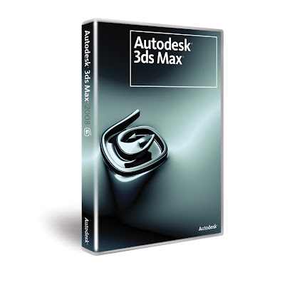
New version of 3D Studio Max out in October

This powerful new toolset gives you immediate feedback on various render settings, enabling you to iterate rapidly. This means you can now quickly hone in on your desired look without waiting for a software render—erfect for over-the-shoulder client/boss feedback sessions and other iterative workflows. Based on the latest game engine technology, Review delivers interactive viewport previews of shadows (including self-shadowing and up to 64 lights simultaneously), the 3ds Max sun/sky system, and mental ray® Architectural and Design material settings.
Monday, 13 August 2007
Dell Axim x51v and Windows Mobile 6
The video above (showing a Dell Axim x51v running Windows Mobile 6!) is the proof that user communities can sometimes overcome little issues such as devices getting obsolete by their manufacturer. It seems that a ROM is out there that allows the new version of the operating system to be loaded on the device. While I'd rather not post any links as to where one can find this ROM, it does reportedly provide Axim users with the capability of upgrade denied by Dell (albeit as a slighty more risque proposition, ROMs like this often tend to be incredibly buggy and are not really recommended). Moreover, it applies further pressure to the manufacturer to step up to the challenges of a still-existing customer base. Have I attemped the upgrade? No way, and I certainly won't as I am not convinced WM5 and WM6 differ greatly but also because I value my device way too much and will always wait for an official update from Dell...
Nintendo developing a new motion sensing portable device?
The housing of the system incorporates an XY-axis acceleration sensor to detect an acceleration in an X-axis and Y-axis direction and a Z-axis contact switch to detect an acceleration in a Z-axis direction. In diagrams (see pic above), the system has been represented by a Game Boy-esque figure, but it could well be that's just a temporary placeholder. While it should be noted that mobile devices with motion sensors are certainly nothing new, this has been more or less limited to cellphones so far and seeing that a device capable of displaying more complex 3D graphics extend to include it as a viable interaction way is very exciting indeed! Time will show what Nintendo will make of this of course as this is a long way from implementation yet. Still, the idea alone sends the imagination reeling when it comes to potential applications...
Monday, 6 August 2007
Tutorial on creating a photorealistic 3D virtual city in under 5 minutes
First of all, you will need a version of Autodesk's 3D Studio Max to follow this quick tutorial. Also, you will need a copy of the excellent Greeble plug-in, developed by Tom Hudson. This is a modifier plug-in useful for generating random detail for everything ranging from spaceship models, cityscapes to Death Stars (!), which can be downloaded from http://max.klanky.com/ (to install it simply copy and paste the Greeble .dlm file in the 3D Studio Max Plugins directory).Step 1: Create a plane in 3D Studio Max with say 25 Length and 25 Width. Make sure Edged Faces is on from the viewport options (very important!).
Step 3: Keeping this in mind move around some vertices here and there in the corners of all buildings to randomize the appearance of the cityscape further.
Step 4: Open up the Material Editor and in a new material slot create a Multi/Sub-Object material. Apply this to the cityscape plane. This is done in order to differentiate different parts of the cityscape. I usually use about 4-5 slots in this but let's keep it simple for this tutorial; use only two and name the 1st Base and the 2nd Garden. Assign a different sub-material to each; say a yellow-ish diffuse color for the Base and green for the Garden.
Step 5: Now under the Polygons selection of the Edit Mesh modifier, assign different material IDs to polygons accordingly. The easy way to do this is to select all polygons, assign them as ID1 (Base) and then select the few Garden polys you want and assign ID2 to them (you will see that the Garden ones turn green while all others remain yellow in color). Finally select ID1, all the Base polys that is.
As you can see, it is fairly simple and time efficient to achieve results such as this for purely random visualisations. Obviously the shortcomings of this are obvious (for starters geographically it is difficult, nigh-on impossible to adapt this technique to a more realistic GIS-driven target) but this method (and the Greeble plug-in itself!) take some beating in the time/quality of result ratio for purely "beauty" renders. (Also do bear in mind that I've tried to keep this really really simple, there are many ways to build on and improve on the few steps described above, by no means is this definitive, feel free to experiment!).
For a future tutorial I will concentrate on the production of expressively rendered (i.e. in a non-photorealistic manner) views of 3D urban models, check the pic above for a cartoon-shaded view of an urban model...
MaPZone, a very useful texturing editing tool
Saturday, 4 August 2007
Google PhotoSketch, a method for image-based rapid photomodelling
The talk can be viewed at the link below and while it clocks in at slightly less than an hour (!) it is well worth watching since it presents general city modelling issues as they stand today, an overview of the system proposed and also results from experiments in large-scale urban scenes. Finally, the results are designed to integrate with Google SketchUp and are thus particularly suited to creating buildings for display in Google Earth.
http://video.google.com/videoplay?docid=-4452669873579375047
Google SketchUp For Dummies book
While the book itself is more than adequate on that, what is even more impressive is that the author has uploaded 62 tutorial vids to compliment the book release and all of these tutorials are entirely free and can be found on YouTube! A great move both in a marketing and also SketchUp-community sense and one that leads me to recommend this book even more! For more info on the book see http://www.sketchupfordummies.com/. The author's vid tutorial site on YouTube can be found at http://www.youtube.com/profile_videos?user=aidanchopra&p=r&page=1.
City GML, providing an open standard for 3D city models
These 3D models can only be used for visualization purposes but not, in most cases, for thematic queries, analytical tasks or spatial data mining. Another problem with these and other city 3D modeling efforts is lack of interoperability. Web-aligned open standard geometry models for computer graphics (e.g., X3D and geospatial technologies (Geography Markup Language 3 (GML3)) are available but still relatively new and not yet widely adopted. Though their common XML foundation provides the elements needed for convergence, this has not been addressed (not yet anyway). Moreover, in those cases where semantic and topological aspects are considered, there are no widely used standard application schemas, though such schemas are under development, drawing on a considerable body of previous data modeling work. Without a common definition of the basic entities, attributes and relations that can be shared over different applications, those who develop and own the models find it difficult to share and maintain them.
So, in short, some of City GML's features include:
- Geospatial information model for urban landscapes based on the ISO 191xx family
- GML3 representation of 3D Geometries, based on the ISO 19107 model
- Texture and material representation of object surfaces
- Taxonomies and aggregations
- Digital Terrain Models as a combination of (including nested) triangulated irregular networks (TINs), regular rasters, break and skeleton lines, mass points
- Sites (currently buildings; bridges and tunnels tbd. in the future)
- Vegetation (areas, volumes, and solitary objects with vegetation classification)
- Water bodies (volumes, surfaces)
- Transportation facilities (both graph structures and 3D surface data)
- City furniture
- Generic City objects and attributes
- User definable (recursive) grouping
- Multiscale model with 5 well-defined consecutive Levels of Detail (LOD):
a) LOD 0 : Regional, landscape
b) LOD 1 : City, region
c) LOD 2 : City districts, projects
d) LOD 3 : Architectural models (outside), landmarks
e) LOD 4 : Architectural models (interior)
- Multiple representations in different LODs simultaneously; generalization relations
- Optional topological connections between feature (sub)geometries
- Application Domain Extensions (ADE): specific "hooks" in the CityGML schema allow to define application specific extensions, for example for noise pollution simulation, or to augment CityGML by properties of the new National Building Information Model Standard (NBIMS) in the US
To provide (only some) names of bodies working on and supporting CityGML: municipalities of Berlin, Hamburg, Cologne, Düsseldorf, Recklinghausen, Leverkusen; British Ordnance Survey, State Mapping Agency of North-Rhine Westphalia; companies T-Mobile, Rheinmetall Defence Electronics, Snowflake, CPA Geo-Information, GIStec, 3D Geo; research institutions: Universities of Bonn, Potsdam, Dortmund, Applied Sciences Stuttgart; Research Centre Karlsruhe and Fraunhofer Institute for Graphics Research.
Friday, 3 August 2007
Sony PSP SDK available discounted for UK universities
The PSP SDK which has been offered to students/researchers will come with the same ProDG programming tools and debugging tools used by professionals in studios worldwide. Students/researchers will be able to get support online through a cloned version of the professional development website, which will have a dedicated forum to cater for all questions. It's been speculated that the launch partners will probably be the University of Abertay Dundee, Sheffield Hallam and Hull, all of which have their own computer games programming courses.
Monday, 23 July 2007
Vibrating GPS navigation
This new idea consits of two vibrating rings which can guide the wearer around a city via global positioning satellite (GPS) have been unveiled by a British designer at the Royal College of Art. The rings are the invention of Gail Knight, who developed them as a way of helping women feel safe in areas they are unfamiliar with.
According to the creator of the proof-of-concept device: "I admit that, as it is rings, they're obviously more attractive to women - and I'd been looking at women and their position in the public sphere, and how safe they feel in a public environment," she told BBC World Service's Culture Shock programme. "I wanted to avoid the route of attack alarms, which nobody really uses, and just find a way of making people feel confident. I integrated that with walking and London, both of which I like, and came up with this device that was very feminine - but at the same time a piece of consumer electronics."
The system works in the following way: not all of the necessary electronics could be put into the rings, so the device controller is worn either around the neck or clipped on to clothing. The controller has a display of eight digits, which allows for a postcode to be entered. It also houses an electronic compass and GPS system, which is what powers the device's navigation. The signal is then transmitted to the two rings, inside of which are a small vibrating motor and antenna. The rings buzz for left and right, and have different vibrations for forwards and backwards. Both buzz when going in the wrong direction.
Final Fantasy's Advent Children Midgar virtual city
As far as photorealistic 3D cities with a definite Blade-Runner similarity go, this one is easily the best I have seen so far, incredibly stylised and detailed as can be seen from the pic above. There was obviously no expense spared regarding rendering costs and time, which is always the case with CGI movies but nonetheless the result is striking enough to leave an impression even to people working with a much smaller polygon count. A fan related Midgar movie showcasing the 3D virtual city even more extensively can be found at the following YouTube link (here).
Monday, 16 July 2007
PSP's Gangs Of London: London's 3D urban model on a mobile device


Windows Live Mobile Search Version 2.0
However the most important feature of Windows Live Mobile Search is... the fact that it is completely free! In fact, it's the only application of its kind paving the way towards a completely free comprehensive LBS product for Pocket PCs.
More information on it at http://wls.live.com, the application can also be downloaded from this location...
Sunday, 15 July 2007
Microsoft Mobile Development Handbook
I can wholeheartedly recommend this book to all with an interest in mobile developing like myself, its up-to-date nature (the only book to date with Visual Studio 2005 coverage!) makes it worthy of purchase alone but the content is very commendable anyway. It can be ordered, amongst other places, from http://www.amazon.co.uk/Microsoft-Mobile-Development-Handbook-Pro/dp/0735623589.
Friday, 13 July 2007
Microsoft's Virtual Earth and Brighton
Speaking of coverage, it is, at the moment at least, definitely not as good as Google's application (for example only a handful of 3D UK cities are available at the moment). However, Virtual Earth seems to be somewhat more better-suited to 3D virtual city models because of the automatic modelling approach Microsoft seems to favour. Seeing that Microsoft's product is also newer it will be very interesting to see in the next year or so which application will be prevalent over the other.
Meanwhile I will continue to feature updates on Virtual Earth (of interest to 3D urban modelling mostly) but till then here is a YouTube flythrough vid of the 3D model of the city I live in (and one of the first two cities uploaded for it a couple of months ago), the seaside-located Brighton (the seaside adjective is definitely a bit ill-suited considering the awful weather we've had this summer but anyway!)...
Google Earth article in IEEE Computer Graphics & Applications Journal
The article itself can be found (despite the fact that the journal is subscription-only they have added a free download of this) at http://www.computer.org/portal/cms_docs_cga/cga/content/Promo/g4008_07.pdf. I think it is an excellent read which above all highlights how Google Earth and in extension 3D urban models & virtual cities on it (or indeed even not on it!) can be of great use in so many fields and areas today...
Project Gotham Racing 4 & St. Petersburg 3D model
The Project Gotham Racing series from Bizarre Creations (now at version 4) has always been at the forefront of 3D urban modelling in games (I remember spending a lot of time admiring the models in PGR 2 which was out on the first version of the Microsoft console) and from the looks of that vid it will continue to be! Moreover, this might just be a good enough incentive for many of us (including myself) to finally shell out for the 360! Till then I will leave you to marvel at the detail of the 3D model of St Petersburg on the YouTube link above...
Location Applications and Positioning Technologies seminar
Below I have included some links about some of the talks which I singled out (although I have to say that I found all of them very topical and stimulating, especially when it comes to research ideas on state-of-the-art technological issues), hopefully I will attend another event like this sometime in the not-too-distant future.
(homepage of the Scientific Research Unit, part of the RNIB Access and Innovation Group, that develops and disseminates RNIB's expertise on the accessibility of information, technology, environment and culture with a strong focus on mobile devices and disabilities)
(tracking solution helping potential clients to address a number of commercial challenges using the latest RFID and Wi-Fi technology, provide real time accurate information about the location of key assets and people)
(an indoor pedestrian navigation prototype system using inertial sensors and motion detection for tracking, as can be found on many current mobile devices)
http://www.trinitymobile.co.uk/
(a solution -and the research and reasoning behind it- to providing services on mobile devices such as mobile tickets, mobile coupons, mobile loyalty, bulk text, SMS to email, email to SMS and multimedia messaging services)
http://www.ordnancesurvey.co.uk/
(a very thorough overview of the UK's leading national mapping data agency roadmap for the future, with some soon-to-be-implemented solutions including full digitisation & farming of road networks, 3D virtual urban models and attemps to promote "greener" urban mapping by promoting pedestrian passings etc.)